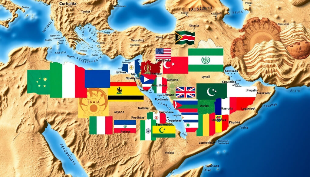
Middle East Map: 17 Countries, Flags, Cities & Facts
Middle East maps routinely contradict each other because the region lacks formal borders—the United Nations itself publishes explicit disclaimers on its official maps. The area from Egypt to Iran contains roughly 17 distinct political entities, and whether a map includes Turkey, Egypt, or even Algeria depends entirely on the cartographer’s definition. This guide anchors every answer to verified sources so readers can navigate the variations with confidence.
Countries: 17 · Core Region: Southwest Asia · Key Inclusion: Arabian Peninsula · Often Included: Egypt, Turkey · Map Types: Political, Physical
Quick snapshot
- 17 countries per Infoplease (World Atlas)
- Core includes Arabian Peninsula, Iran, Iraq, Levant (Wikipedia)
- UN map reference 4102r05 carries boundary disclaimers (United Nations)
- Exact Turkey inclusion varies by definition (World Atlas)
- North Africa extensions debated by scholars (World Atlas)
- Palestine status: recognized by 134 countries, not UN member (World Atlas)
- Map variations (political, physical, flag maps) serve different purposes
- Syria flag changes reflect ongoing political shifts
- Territorial disputes (Golan Heights, Abu Musa) affect border rendering
| Field | Value |
|---|---|
| Countries Count | 17 (MENA) |
| Primary Continent | Asia |
| Signature Map Source | World Atlas |
| UN Map Reference | 4102r05 |
| Pan-Arab Colors Origin | 1916 |
| Flag Adoptions Span | 1915–2002 |
Which countries are part of the Middle East?
Political maps of the Middle East typically include countries like Bahrain, Egypt, Iran, Iraq, Israel, Jordan, Kuwait, Lebanon, Oman, Palestine, Qatar, Saudi Arabia, Syria, Turkey, United Arab Emirates, and Yemen (World Atlas). The geopolitical region spans the Arabian Peninsula, Egypt, Iran, Iraq, the Levant, and Turkey according to standard definitions (Wikipedia).
Core countries
The heart of the region sits on the Arabian Peninsula, where Saudi Arabia dominates in land area. The Levant countries—Jordan, Lebanon, Syria, and Palestine—share proximity to the Mediterranean. Iraq anchors the eastern flank between Iran and the Gulf states. Each political map may weight these groupings differently depending on the cartographer’s purpose.
The UN’s official map (reference 4102r05) explicitly states that boundaries and names shown do not imply official endorsement or acceptance by the United Nations, reminding users that even authoritative maps carry disclaimers.
Extended inclusions like Egypt
Egypt geographically straddles Africa and Asia, with the Sinai Peninsula bridging the continents. Many definitions include Egypt because its Mediterranean coast faces the Levant, and its cultural ties to Arab history run deep. Egypt’s flag, adopted in 1984, features the Eagle of Saladin and uses the Pan-Arab color scheme of red, white, black, and gold (Playaling). The colors symbolize the struggle for independence, peace, and the overcoming of oppression.
For map readers, the implication is clear: Egypt’s inclusion depends on whether the map prioritizes geography or political-regional definitions. Neither approach is wrong—they simply serve different analytical purposes.
Is Turkey in the Middle East?
Turkey occupies a peculiar position on most Middle East maps, included by many definitions but not all. The country’s location spans two continents, with 97% of its land in Asia and 3% in Europe.
Geographic overlap
Anatolia—Turkey’s Asian portion—borders Syria, Iraq, and Iran, making geographic sense of its inclusion. Turkish cultural and historical ties to the region run deep, from the Ottoman era through modern trade relationships. Maps from the United Nations include Turkey in their Southwest Asia designations (United Nations).
Political definitions
Some analysts exclude Turkey from strictly “Middle Eastern” categorization, preferring to classify it as European or Mediterranean. Turkey’s NATO membership and EU candidacy process have pushed it toward Western political frameworks. However, most atlas maps and regional studies include Turkey in Middle Eastern discussions because of its shared borders and cultural connections.
Is the Middle East technically Europe or Asia?
The Middle East sits primarily in Asia’s Southwest region, but the boundaries are not clean. Egypt’s Sinai Peninsula crosses into Africa, while Turkey spans Europe and Asia. This transcontinental nature complicates any simple continental label.
Continental placement
Geographically, the Middle East belongs to Asia—the continent occupying the largest landmass from Turkey’s western border eastward. The Arabian Peninsula, Persian Gulf region, and Levant all fall within Asian subregions. Wikipedia confirms the Middle East geopolitical region “includes Arabian Peninsula, Egypt, Iran, Iraq, Levant, Turkey” (Wikipedia).
Transcontinental aspects
The Golan Heights, occupied by Israel since the 1967 Six-Day War, further complicate regional borders (World Atlas). Cyprus sits in the Mediterranean but sometimes appears on Middle East maps due to cultural and political ties. The Abu Musa island dispute—Iran-administered but UAE-claimed—shows how territorial issues can reshape perceived regional boundaries.
For map publishers, the challenge is real: including transcontinental countries like Turkey and Egypt means accepting that continental labels become approximations rather than absolutes.
What are the top 3 largest countries in the Middle East?
Saudi Arabia ranks as the largest country by land area in the Middle East, covering roughly 2.15 million square kilometers. Iran follows as the second-largest, while Algeria—a North African nation sometimes included in broader definitions—represents the third.
By land area rankings
Saudi Arabia dominates the Arabian Peninsula, its territory extending from the Red Sea coast to the Persian Gulf. Iran’s plateau geography spans from Turkey’s border eastward to Afghanistan and Pakistan. Algeria, when included in MENA (Middle East and North Africa) counts, adds substantial North African territory to the regional ranking.
The remaining top contenders include Libya, Sudan (when included), Kazakhstan (transcontinental), and Egypt with its Sinai extension. Each map’s definition affects which rankings appear authoritative.
Why is Iran not considered an Arab country?
Iran’s official language is Persian (Farsi), not Arabic. While Iran shares the region’s Islamic culture and borders several Arab nations, its distinct ethnic identity, language, and historical heritage separate it from the Arab world.
Iran’s flag uses green, white, and red with specific Persian design elements rather than the Pan-Arab color scheme shared by most Arab flags (Playaling). The distinction matters on any flag map of the Middle East because Iran’s national symbol communicates a separate civilizational lineage—one rooted in Persian empires rather than the Arab Caliphates.
Who is the richest country in the Middle East?
The United Arab Emirates and Qatar often rank among the highest in GDP per capita, though wealth distribution varies significantly across the region (World Atlas). Saudi Arabia holds the largest total oil reserves, while smaller Gulf states like Kuwait and Bahrain have smaller but still significant per-capita wealth.
The pattern that emerges is that sovereign wealth funds and small populations inflate per-capita figures for UAE and Qatar, while Saudi Arabia leads in total energy resources—meaning the answer to “richest” depends entirely on whether the metric measures individual prosperity or national resource dominance.
Middle East Map Variations
Different map types serve distinct purposes for different audiences. Political maps emphasize borders and country boundaries. Physical maps highlight terrain, mountain ranges, and water sources. Flag maps overlay national symbols on territorial boundaries.
With cities
City-labeled maps identify capital cities and major urban centers—Riyadh, Tehran, Baghdad, Cairo, Istanbul. These maps help readers understand population distribution and historical settlement patterns.
With flags
Flag maps represent each country by its national symbol, making visual identification easier. Stock images and 3D illustrations often combine political boundaries with flag overlays (Alamy).
Most Arab flags share the Pan-Arab colors—black, white, green, and red—first combined in the 1916 Arab Revolt flag. Black represents the Abbasid caliphate, white the Umayyads, green the Fatimids and Islam, and red the Hashemite dynasty (Wikipedia). Jordan’s flag directly derives from the Arab Revolt design, adopted in 1928 (Playaling).
The implication for map readers is that shared flag colors signal shared history—the Pan-Arab color scheme encodes four distinct caliphate dynasties into national identity—while non-Arab flags like Iran’s and Turkey’s communicate entirely separate civilizational narratives.
Political map
Political maps show recognized borders, disputed territories, and administrative divisions. The UN’s official boundaries carry explicit disclaimers about political endorsement (United Nations).
War zones
Some maps identify active conflict zones or disputed territories—Golan Heights, Abu Musa island, Kurdish autonomous regions in Iraq. These designations change frequently and reflect politically sensitive interpretations.
What we know versus what’s debated
Confirmed facts
- The standard list includes 17 countries
- Pan-Arab colors date to 1916
- Most Arab flags incorporate shared color symbolism
- Saudi Arabia is the largest country by area
- Turkey spans two continents
What’s unclear
- Whether Turkey belongs on strict Middle East definitions
- Whether North African nations should be included
- How current Syria flag changes will be formalized
- Which 134 countries officially recognize Palestine
What the sources say
“The boundaries and names shown and the designations used on this map do not imply official endorsement or acceptance by the United Nations.”
— United Nations Map Section (official map disclaimer)
“The green represents Islam, the white symbolizes peace and purity, and the red represents bloodshed during the struggle for independence.”
— Playaling (educational resource on Arab flag symbolism)
“Pan-Arab colors are black, white, green, red, first combined in 1916 Arab Revolt flag; black for Abbasids, white for Umayyads, green for Fatimids, red for Hashemites.”
— Wikipedia (Pan-Arab colors article)
Related reading: SAS Rogue Heroes North Africa campaign · The Passion of the Christ historical setting
123rf.com, nationalflags.shop, dreamstime.com, istockphoto.com, commons.wikimedia.org, stock.adobe.com
Core Southwest Asia features 17 countries whose boundaries vary by source, much like those traced on this detailed Middle East map with capitals and key insights.
Frequently asked questions
Why is Iran not considered an Arab country?
Iran’s official language is Persian (Farsi), not Arabic. While Iran shares the region’s Islamic culture and borders several Arab nations, its distinct ethnic identity, language, and historical heritage separate it from the Arab world. Iran’s flag uses green, white, and red with specific Persian design elements rather than the Pan-Arab color scheme.
What was Saudi Arabia called before?
The region was historically known as Arabia. The modern Kingdom of Saudi Arabia formed in 1932 when King Abdulaziz unified the Kingdom of Hejaz and Najd. Before the kingdom’s formation, the territory included various tribes, emirates, and Ottoman-controlled areas.
Who is the richest country in the Middle East?
The United Arab Emirates and Qatar often rank among the highest in GDP per capita, though wealth distribution varies. Saudi Arabia holds the largest total oil reserves, while smaller Gulf states like Kuwait and Bahrain have smaller but still significant per-capita wealth.
What are the 7 Arab countries?
The phrase “7 Arab countries” typically refers to the original members of the Arab League founded in 1945: Egypt, Iraq, Jordan, Lebanon, Saudi Arabia, Syria, and Yemen. The league has since expanded to 22 member states across the Arab world.
What countries border the Middle East?
Countries bordering the core Middle East region include Afghanistan, Pakistan, Azerbaijan, Georgia, Armenia, and the Mediterranean Sea. The region’s northern borders touch the Caucasus and Black Sea, while eastern boundaries reach the Persian Gulf’s extent.
How many countries are in the Middle East?
The standard count includes 17 countries, though definitions vary. Most sources agree on Bahrain, Egypt, Iran, Iraq, Israel, Jordan, Kuwait, Lebanon, Oman, Palestine, Qatar, Saudi Arabia, Syria, Turkey, UAE, and Yemen. Algeria and Libya sometimes appear on broader MENA definitions.
More related posts
 Brooke Monk: Age, Net Worth, Height, Boyfriend & Bio
 Bosch Series 8 Washing Machine: Problems, Lifespan & Reset
 Shaggy Scooby-Doo: Character Guide, Catchphrases & Theories
 Real Housewives of Beverly Hills – Season 14 Cast and Guide
 Toyworld Near Me: Irish Stores, Hours & Toys Guide
 Who is Lanlan Yang? Sydney Rolls-Royce Crash Mystery Explained
 Little Tikes Story Dream Machine: Complete Guide & Review
 Iyo Sky: Personal Life, Career, and 2026 Queen of the Ring